| Briefing | 17th September 2015 |
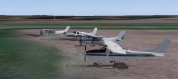
| Start Time and Place | 18:30 to 19:00 zulu - The Clubhouse at Biggin Hill. |
| Departure and Duration | We will depart in ones or twos when ready. The following times do not include time spent on the ground. Cruising at 105 knots, it will take about 1 hr 10 mins. Cruising at 180 knots, it will take about 45 mins. |
| Weather ...or not | Before starting we will check the weather en route. If it is unsuitable for our trip as planned, then we will fix it.
Something we can do in the simulator - wouldn't it be nice if we could do it in real life! FSInn has a "CAVOK" button. Click this and you get calm clear weather. Those using SB3/SB4 will need to turn off the on-line weather updates, and select calm in the FS weather options. |
| Routing Overview | The route will take us over the Thames to Southend, and from there to Clacton on the east coast. From there we will follow the coast line in a north easterly direction, as far as Great Yarmouth, with a short stop at Beccles, before turning inland to Norwich. |
|
Flight Plan |
Your flight plan should show: departure = EGKB, destination = EGSH, alternate = EGSJ,
route = DCT EGMC - EGSQ - EGSM - Gt Yarmouth, and comments = /V/ DAYLIGHT / CIX VFR CLUB All bearings and headings given in the briefing below are magnetic, and no allowance has been made for any cross wind. Airfield charts and information are available from the AIS web site. The alternate destination, Seething is 9 nm SSE of Norwich city. It has a short, narrow runway = 800m by 18m, and no radio navigation aids. |
|
Biggin Hill to Southend |
Before departure, file your flight plan, set your ADF radio to SND 362.5, and NAV1 radio to I-ND 111.35 for the DME, and
your transponder to 7000. Set the local QNH by pressing the 'B' key. Contact ATC for taxi instructions and clearance for your departure as filed. Follow the
instructions you are given to taxi out to the active runway. You can expect clearance to include a turn to the east for 4 nm before turning towards Southend.
Set squawk mode Charlie as you take up the runway. From runway 21, a left turn to the east after 2nm will take you towards the Sevenoaks VRP. From there, Southend is about 25nm at 053 degrees. You will pass Gravesend on your left well before crossing the Thames to go over Canvey Island, with Southend just ahead. From runway 03, a right turn after 1.5nm puts Southend about 27nm at 067 degrees. This way you will pass Gravesend on your right, and cross the Thames twice before reaching Canvey Island, with Southend just ahead. |
|
Southend to Clacton |
Set radios NAV1 = CLN 114.55. The direct track from Southend to Clacton is 055 degrees and the distance is 20 nm. After 5nm we pass over the river Crouch, with Burnham-on-Crouch on the northern bank. Another 6nm and we cross the coast. As we cross the water here, we can think of the village of Tiptree, which is about 10nm away on our left. This is where those famous jams are made by Wilkin & Sons. Clacton airport is on the opposite coast, 4nm short of the CLN VOR. If you miss it, turn back from the beacon on 193 degrees. Here's your chance to try a short field landing. The grass runway is 610m x 18m, lying north-south. |
|
Clacton to Beccles |
Keep NAV1 tuned to CLN 114.55 to check the distance travelled. From Clacton we will follow the coast and observe some of
the more interesting sights. Right next to the airport we have the first of several seaside resorts, Clacton-on-Sea. This is closely followed by Frinton-on-Sea,
and Walton-on-the-Naze. The Naze is the nose shaped promontory, jutting out to the north, which shelters the backwaters behind it. This whole coast is continually
under threat of erosion by the sea. There is an active Naze Preservation group, which has made a successful bid for some lottery funding. Next we come to the ports of Harwich and Felixstowe, on either side of a shared estuary. The river Stour off to the west, and the river Orwell to the north west. You may have heard of the Stour Valley, Dedham Vale, Flatford Mill - this area is known as Constable country, where John Constable painted many of his landscapes. Thomas Gainsborough did some here as well. The river Orwell flows down from Ipswich East Suffolk's county town. The A14 crosses the Orwell over a spectacular bridge. Several ferry routes start and end at Harwich, whereas Felixstowe is a large container port. After Felixstowe we cross the river Deben which flows down from Woodbridge, a quaint little town with an old mill on the waterfront, and a lot of pleasure boats in the water. About 8nm after the river Deben we come to the start of what appears to be a long narrow island. We find eventually that it is joined onto the mainland at it's other end, 12nm further on. This is Orford Ness, separated from the mainland by the river Alde. Orford Ness was the site of much top secret military activity during both World Wars, and long afterwards into the Cold War period. There is still said to be a danger from unexploded ordnance. It is now a unique Nature Reserve owned by the National Trust. Just after the river Alde finally turns inland, we come to Aldeburgh, and just inland from there the Snape Maltings, where much beautiful music is played. Another 6nm and we come to the Sizewell nuclear power station. Then a couple of miles further there is what is left of Dunwich - most of this town is now under the sea, due to the effects of coastal erosion. At 34nm from the CLN VOR is the seaside resort of Southwold, from which we should be able to see our next port of call, EGSM Beccles, at about 345 degrees 6nm away. A concrete and grass runway running east-west 696m x 18m, means another short field landing. |
|
Beccles to Norwich |
Set the ADF to NWI 342.5 and NAV1 to I-NH 110.90 for the DME. From Beccles fly back out to the coast before turning north
over Lowestoft, and then on to Great Yarmouth. During my school days, I spent most of my summer holidays here in a caravan on the South Denes. I remember cycling
there from Bury St Edmunds one year, a distance of 57 miles, and then back again when the holiday came to an end - I was much fitter then! Norwich airport is just on the northern outskirts of the city. It used to be RAF Horsham St Faith. I was stationed there for a while during my time in the RAF. We should be under control from Norwich Approach by now, with about 17nm to go from the South Denes of Great Yarmouth, the direct track is 296 degrees. Join the circuit as instructed, land and taxi to the Light Aircraft Park, which is on the western edge of the field, south of the main east-west runway. |
|
Divert to Seething |
If you have to divert to Seething, you will find the airfield 9nm south south east of Norwich. According to Pooley's it is located at CLN 018 41, which means 41nm from the CLN VOR on the 018 degrees radial. Track the Norwich NDB outbound on 158 degrees to get there. |
| NDB Tracking | The Instrument Flight document in the Training section of the club web site contains a section on NDBs and how to use them. If you are unsure how to track NDBs, download and have a look at this. |
|
Radio Discipline |
Take care not to let our Teamspeak chat cut across ATC. Stop any conversation immediately the R/T comes alive, then continue
if "he wasn't talking to us". This is difficult because when transmitting on Teamspeak you can't hear the R/T. So be brief on Teamspeak, and be aware
that ATC might be trying to get through. If anyone hears an R/T message which seems to be being ignored, just say "ATC is calling G-CIXN" if you have
identified the callsign, or "ATC is calling us" which is a cue for everyone to be quiet on Teamspeak until ATC call again (which they will). Remember
too that if asked to "Stand By" by ATC, you do not reply - not even "Roger", but simply wait until you are called again. Remember also that there are several different ATC frequencies in use, and you may not be able to hear when communications are taking place. Make sure you have set and know how to use a Teamspeak mute switch. |
|
|
|
Version 1.1 - 05:30 ZULU 27/09/15 |