| Briefing | 24th September 2015 |
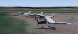
| Start Time and Place | 18:30 to 19:00 zulu - The Light Aircraft parking area at Norwich. |
| Departure and Duration | We will depart in ones or twos when ready. The following times do not include time spent on the ground. Cruising at 105 knots, it will take about 1 hr 30 mins. Cruising at 180 knots, it will take about 1 hr. |
| Weather ...or not | Before starting we will check the weather en route. If it is unsuitable for our trip as planned, then we will fix it.
Something we can do in the simulator - wouldn't it be nice if we could do it in real life! FSInn has a "CAVOK" button. Click this and you get calm clear weather. Those using SB3/SB4 will need to turn off the on-line weather updates, and select calm in the FS weather options. |
| Routing Overview | The route will take us south from Norwich along the railway line to Haughley Junction, then west over Bury St Edmunds and Newmarket to Cambridge. From there we head for Duxford, then the Pirton VRP, and into Luton, south from Luton to the Hemel Hempsted VRP, across to Stapleford, to Dartford, and home to Biggin Hill. London City will be open for an optional touch and go. |
|
Flight Plan |
Your flight plan should show: departure = EGSH, destination = EGKB, alternate = EGLC,
route = Haughley - EGSC - EGSU - Pirton VRP - EGGW - Hemel VRP - EGSG - Dartford, and comments = /V/ DAYLIGHT / CIX VFR CLUB All bearings and headings given in the briefing below are magnetic, and no allowance has been made for any cross wind. Airfield charts and information are available from the AIS web site. Two other useful reference documents are the CONTROL ZONE AND CONTROL AREA CHART for London Stansted, and the CONTROL ZONE AND CONTROL AREA CHART for London Luton. |
|
Norwich to Cambridge |
Before departure, file your flight plan, set your ADF radio to CAM 332.5, NAV1 radio to WTM 109.30, NAV1 standby to
I-CMG 111.30, and your transponder to 7000. Set the local QNH by pressing the 'B' key. Contact ATC for taxi instructions and clearance for your departure
as filed. Follow the instructions you are given to taxi out to the active runway. You can expect clearance to include a climb straight ahead to 1000 feet
before turning towards the south. Set squawk mode Charlie as you take up the runway. The railway line we want to follow leaves Norwich to the south close to the centre of the built up area. It heads 205 degrees directly towards RAF Wattisham, which is used mainly by Army helicopters. About 19 nm from Norwich we pass over the town of Diss, which is on the border between Norfolk and Suffolk. There is a fairly large road junction just to the east of Diss. On your right you will probably catch sight of RAF Honington. About 9 nm from Diss, and 6 nm short of the Wattisham air base, the railway line swings left to Haughley Junction then on towards Ipswich. At Haughley we turn right towards Bury St Edmunds, about 10 nm on 280 degrees, keeping to the south of the large military zone. Bury has the remains of a large Abbey, where St Edmund was buried, hence the name. This is where the barons met to draft the Magna Carta, later signed by King John at Runnymead. The beautiful Cathedral has a new tower, only recently completed as a millennium project. (You won't see my house, because it wasn't built when the GetMapping photographs were taken.) RAF Honington, just to the north, used to be a V-bomber base during the cold war. It is used now mainly as a diversion field for the large American complex of Mildenhall and Lakenheath. There are about 10,000 US service personnel and their families living and working in this area. Mildenhall is used by various transport and re-fueling tankers. Lakenheath is used for their fighter bombers. I doubt if we will see any of these in the virtual world. From Bury St Edmunds, we need to track 274 degrees for about 12 nm to pass over Newmarket, famous for its horses. You will probably catch sight of the race course to the west of the town. From here Cambridge is only 8 nm on 263 degrees. Join the circuit and land as instructed, then taxi to the General Aviation parking area, for a short rest stop. |
|
Cambridge to Luton |
Set radios ADF = LUT 345.0, NAV1 = BKY 116.25, NAV1 standby = I-LJ or I-LTN 109.15 for DME. Note that neither LUT nor BKY
are on the airfield. The direct track from Cambridge to Duxford is 195 degrees and the distance is 7 nm. Duxford houses part of the Imperial War Museum. If you
intend to include the optional touch and go at Duxford, be sure to inform the Cambridge controller before departing. Cambridge will probably hand us over to
Essex Radar (aka Stansted Approach) soon after departure, so you may have to request your touch and go at Duxford again. Next our route takes us to the Pirton VRP, which is our entry point into the Luton zone. Pirton VRP is 18 nm from Duxford bearing 252 degrees. Use the CAA On-Track map to help locate it. From Pirton, Luton is 6 nm on 197 degrees. It is possible that we will be asked to route to Luton via the Nuthampsted VRP, which is very close to the BKY VOR, and then perhaps via Puckeridge VRP. Study the map and be prepared for that as well. Expect to be handed over to the Luton controller to joining the Luton circuit. We can land at Luton for a short break, or simply touch and go before continuing. |
|
Luton to Stapleford |
Set the ADF = LCY 322.0, NAV1 = LAM 115.60, and NAV1 standby = BIG 115.10 The Hemel VRP is 7 nm from Luton at 196 degrees. Turn left at Hemel to 110 degrees, and follow the M25 motorway which passes just north of Stapleford. Alternatively, track the Lambourne VOR which is close to Stapleford. Hemel to Stapleford is 21 nm. Here again there is an optional landing or touch and go. |
|
Stapleford to Biggin Hill |
Leave the radios as set. We might need the LAM VOR to check the course to Dartford. Continue to follow the M25, south east and then south to Dartford. Alternatively, track 163 degrees from LAM VOR for 12 nm. At Dartford, switch the NAV1 to standby, for BIG. Turn right to 230 degrees. Biggin Hill is 12 nm from Dartford. There's an option for touch and go at London City on this leg. |
|
Divert to London City |
If you have to divert to London City, you should return to Dartford, and follow the river Thames towards the city, unless otherwise directed. |
| NDB Tracking | The Instrument Flight document in the Training section of the club web site contains a section on NDBs and how to use them. If you are unsure how to track NDBs, download and have a look at this. |
|
Radio Discipline |
Take care not to let our Teamspeak chat cut across ATC. Stop any conversation immediately the R/T comes alive, then continue
if "he wasn't talking to us". This is difficult because when transmitting on Teamspeak you can't hear the R/T. So be brief on Teamspeak, and be aware
that ATC might be trying to get through. If anyone hears an R/T message which seems to be being ignored, just say "ATC is calling G-CIXN" if you have
identified the callsign, or "ATC is calling us" which is a cue for everyone to be quiet on Teamspeak until ATC call again (which they will). Remember
too that if asked to "Stand By" by ATC, you do not reply - not even "Roger", but simply wait until you are called again. Remember also that there are several different ATC frequencies in use, and you may not be able to hear when communications are taking place. Make sure you have set and know how to use a Teamspeak mute switch. |
|
|
|
Version 1.1 - 05:30 ZULU 27/09/15 |