| Briefing | October 2016 |
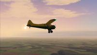
| Overview | The plan is a "mystery tour", starting at EGKB Biggin Hill, and from the final waypoint flying direct to Shoreham EGKA to land. |
| Start Time and Place | The event may be flown on any day in October. In fact this time due to the nature of the event it is better flown alone rather than in company! However the date of Tuesday 18th has been chosen for those who insist on flying in company. I would advise that if you do want to fly with other members (and get lost together!) on the 18th then log onto Teamspeak by 1900z (2000 UK Local). |
| Route | Take off and depart Biggin Hill for Sevenoaks VRP. (The exercise starts as you overfly the VRP. The Sevenoaks VRP is situated 6.5 nm from Biggin Hill on bearing 125 degrees, adjust your heading depending on the direction of takeoff. Start exercise!
Notes: 1. Some of this flight takes place under the London Heathrow TMA - take care to stay below 2400 ft and avoid controlled airspace. 2. "NE##" stands for "Navegation Exercise waypoint ##" These waypoints are arbitrary in location, so don't expect to see any specific landmarks. |
| Flight Planning | Your flight plan should show:
So in the flight plan I suggest 1 hour 10 minutes, of course adjusted to allow for the actual airspeed of your aircraft. |
| Weather | Do use VATSIM weather. You might even choose your day to get better weather for the challenge, as VFR pilots have to, real world. |
| What Aircraft can I fly | Any aircraft can be flown in this event as long as it is within the EASA GA category. |
| Plan-G | Due to the nature of this event there is no PlanG file! |
| ATC | At the time of publishing this event plan, ATC has not been confirmed. |
| Radio Discipline | Take care not to let our Teamspeak chat cut across ATC. Stop any conversation immediately the R/T comes alive, then continue if "he wasn't talking to us". This is difficult because when transmitting on Teamspeak you can't hear the R/T. So be brief on Teamspeak, and be aware that ATC might be trying to get through. If anyone hears an R/T message which seems to be being ignored, just say "ATC is calling G-CIXN" if you have identified the callsign, or "ATC is calling us" which is a cue for everyone to be quiet on Teamspeak until ATC call again (which they will). Remember too that if asked to "Stand By" by ATC, you do not reply - not even "Roger", but simply wait until you are called again. Remember also that there are several different ATC frequencies in use, and you may not be able to hear when communications are taking place. Make sure you have set and know how to use a Teamspeak mute switch. |
| Acknowledgements | Event planning & Briefing: Max Symons Edited by Tony Driver. |
| |
|
Version 1.2 - 11:15 ZULU 24/09/16 |