| Briefing | 17th June 2015 |
| Overview |
The June Event we will be visiting a selection of Wiltshire's pre-historic sites of interest - mainly the collection of "white horses". (Some of these it must be admitted are not that ancient, having been created/cut into the hillside in relatively modern times!) |
| Start Time and Place |
The event may be flown on any day in June, however the date of Wednesday 17th has been chosen for those who wish to fly in company. |
| What Aircraft can I fly |
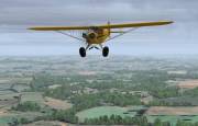
Any aircraft can be flown in this event as long as it is within the EASA GA category. |
| Flight Planning | Your flight plan should show:
At 80 knots this Route should take about 1hour 30 minutes. (*) The map of Australia was above the tented barracks where the ANZAC regiments were quartered before being sent into action in WWI. It is now so faded/overgrassed that it can only be detected on foot, and then only if you know what to look for! Unless your photo scenery has been "touched-up" do not expect to discern this feature. The Plan-G file for this Event can be downloaded from HERE. |
| ATC | At the time of publishing this event plan, ATC has not been confirmed. |
| Radio Discipline |
Take care not to let our Teamspeak chat cut across ATC. Stop any conversation immediately the R/T comes alive, then continue if "he wasn't talking to us". This is difficult because when transmitting on Teamspeak you can't hear the R/T. So be brief on Teamspeak, and be aware that ATC might be trying to get through. If anyone hears an R/T message which seems to be being ignored, just say "ATC is calling G-CIXN" if you have identified the callsign, or "ATC is calling us" which is a cue for everyone to be quiet on Teamspeak until ATC call again (which they will). Remember too that if asked to "Stand By" by ATC, you do not reply - not even "Roger", but simply wait until you are called again. Remember also that there are several different ATC frequencies in use, and you may not be able to hear when communications are taking place. Make sure you have set and know how to use a Teamspeak mute switch. |
| Acknowledgements | Event planning: David Buderim, John Cronan, and Jim Cartwright Briefing: Max Symons. |
| |
|
Version 1.0 - 06:15 ZULU 17/05/15 |