| Briefing | 30th April 2017 |
| Overview | Isla de los Estados - Staten Island, is a remote wild Island at the eastern tip of Tierra del Fuego, south of Patagonia, near Cape Horn and the Drake passage. This island has been very recently opened to tourism. |
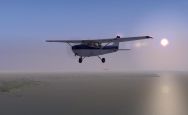
| Event | Basic fuel and low level VFR navigation exercise, testing pilot in favoured quick airframe to reach destinations with estimated timings and fuel whilst overflying nature reserves using QDM tool in Plan G offline. Do not connect to Plan G unless geographically challenged. Land at SFAL Stanley (09/27 918m Asphalt). EGYP (RAF Mount Pleasant) IS MATZ and Out Of Bounds (UNLESS POOR WEATHER OR EMERGENCY). A/C should be capable of minimum 200KTS (to either keep up or keep it less than 2 hours (distance approx. 490nm)). If you wish to fly smaller A/C, then not a problem but expect a longer flight. High crosswinds can be expected with R/W weather. This is a personal confirmatory test of fuel and wind calculations at a pre designed altitude, using QDM and your own in flight calculations for time (whilst checking out the local birds chicks Penguins)! |
| Objective | Were your initial fuel calculations and wind calculations correct? Did you use VOR radials to correct? There is no right or wrong answer, just personal learning / confirmation. |
| Nature Tour Background (info from WIKI) | Isla de los Estados (Staten Island) is covered with dense low forests of Nothofagus southern Beech. The animal life is composed mainly of penguins, orcas, seals, seagulls and cormorants, as well as the human-introduced deer and goats. It has been declared an "Ecological, Historic, and Tourist Provincial Reserve" ("Reserva provincial ecológica, histórica y turística"), with access limited to tours from Ushuaia. The only settlement is the Puerto Parry Naval Station, located in a deep and narrow fjord on the northern coast of the island. The naval station, established in 1978, is manned by a team of four marines on a 45-day rotation and they monitor environmental conservation and ship movements and provide emergency assistance. The San Juan del Salvamento Lighthouse was inaugurated on May 25, 1884, by Comodoro Augusto Lasserre and it operated until September 1900. The lighthouse, better known as Faro del fin del mundo ("Lighthouse at the end of the world"), is said to have inspired Jules Verne's novel The Lighthouse at the End of the World (1905). A military prison was based on the island from 1899 to 1902 but it had to be moved to Tierra del Fuego after being compromised by the strong winds. Isla de los Estados (Staten Island) is covered with dense low forests of Nothofagus southern Beech. The animal life is composed mainly of penguins, orcas, seals, seagulls and cormorants, as well as the human-introduced deer and goats. It has been declared an "Ecological, Historic, and Tourist Provincial Reserve" ("Reserva provincial ecológica, histórica y turística"), with access limited to tours from Ushuaia. The only settlement is the Puerto Parry Naval Station, located in a deep and narrow fjord on the northern coast of the island. The naval station, established in 1978, is manned by a team of four marines on a 45-day rotation and they monitor environmental conservation and ship movements and provide emergency assistance. The San Juan del Salvamento Lighthouse was inaugurated on May 25, 1884, by Comodoro Augusto Lasserre and it operated until September 1900. The lighthouse, better known as Faro del fin del mundo ("Lighthouse at the end of the world"), is said to have inspired Jules Verne's novel The Lighthouse at the End of the World (1905). A military prison was based on the island from 1899 to 1902 but it had to be moved to Tierra del Fuego after being compromised by the strong winds. Sea Lion Island (Isla de los Leones Marinos) is the largest of the Sea Lion Island Group of the Falkland Islands and lies southeast of Lafonia (East Malvinas). It was designated a Ramsar site on 24 September 2001 and the Sea Lion Island Settlement is the southernmost inhabited settlement of the Falkland Islands. The island has two airstrips. Historically, Sea Lion Island was a sheep farm and a base for slaughtering penguins to render for oil. When the British ship Viscount was wrecked in 1892, the wreckage was used to build the farmhouse. Some 56 species of flowering plants have been recorded, including the Fuegian violet which, in the Falklands, is found nowhere else.The island is known for its marine mammals, including breeding colonies of Southern Sea Lions and Southern Elephant Seals, for which the other islands in the group are haul-out sites. Killer whales occur offshore. The Sea Lion Islands Group has been identified by Birdlife International as an Important Bird Area. It is a significant breeding site for a variety of seabirds and other water birds. |
| Start Time and Place | The event may be flown on any day in April, however it should ideally be flown on Sunday 30th. I would advise that if you do want to fly with other members during the event then log onto Teamspeak on Sunday 30th at 1800z (1900 UK time=BST) |
| What Aircraft can I fly | Any aircraft can be flown in this event as long as it is within the EASA GA category. |
| Weather | Before starting we will check the weather. If it is unsuitable for our trip as planned, then we will fix it. Something we can do in the simulator - wouldn't it be nice if we could do it in real life! For the general handling we need a cloud base that is at least 3000ft AGL. FSInn has a "CAVOK" button. Click this and you get calm clear weather. Those using SB or XSB will need to turn off the on-line weather updates, and select calm in the FS weather options. The weather in the South Atlantic is generally poor for VFR flying, so seldom done, but April seems to be ideal based on the following stats: Ushuaia: The average temperature in Ushuaia in April is cool at 5.7 °C (42.26 °F) and afternoons can be a little cool with average high temperatures reaching 9.6 °C (49.3 °F). The weather in April is slightly dry. Only 56.1mm (2.2in) of water is discharged. The shortest day is 9:23 long and the longest day is 11:31 long with an average length of 10:26. Stanley: The average temperature in Stanley in April is cool at 6 °C (42.8 °F) and afternoons can be a little cool with average high temperatures reaching 9 °C (48.2 °F). The weather in April is a little parched with rain, sleet or snow now and again. A mere 46mm (1.8in) of water is discharged across an average of 11 days. In April the skies in Stanley are somewhat dreary with on balance merely 3:42 of beaming sunlight per day with the shortest day 9:40 long and the longest day is 11:34 long with an average length of 10:36. If RW Weather proves unpractical, then fair weather with 27020KT >9999 SCT055 Q0989 would be fair. |
| Scenery | The area is bare on scenery so it is highly recommend getting scenery for the event. It was found that the following rikkoooo free scenery proved to add outstanding quality over the islands and significantly enhanced it. If you have any recommendations on the area please recommend. OFX South America Evolution: http://www.rikoooo.com/downloads/viewdownload/68/802(1.66Gb) Ushuaia Malvinas Argentinas Intl Airport: http://www.rikoooo.com/downloads/viewdownload/88/772 (216Mb) Since the addition of the AI shipping, cruise ships in the bay and estuary. |
| Flight Planning | Your flight plan should show:
|
| Plan-G | There is no Plan-G file for this Event!: -
*Do not connect to Plan G unless geographically challenged ... trust yourself! *VOR MTP @ 2000ft roughly connects at 100NM. Use it as you would do RW to steer back on course / radials if required (utilising Plan G QDM). VOR MTP is approximately 70nm from Beauchene Island on R20! |
| ATC | At the time of publishing this event plan, ATC has not been confirmed. |
| Radio Discipline | Take care not to let our Teamspeak chat cut across ATC. Stop any conversation immediately the R/T comes alive, then continue if "he wasn't talking to us". This is difficult because when transmitting on Teamspeak you can't hear the R/T. So be brief on Teamspeak, and be aware that ATC might be trying to get through. If anyone hears an R/T message which seems to be being ignored, just say "ATC is calling G-CIXN" if you have identified the callsign, or "ATC is calling us" which is a cue for everyone to be quiet on Teamspeak until ATC call again (which they will). Remember too that if asked to "Stand By" by ATC, you do not reply - not even "Roger", but simply wait until you are called again. Remember also that there are several different ATC frequencies in use, and you may not be able to hear when communications are taking place. Make sure you have set and know how to use a Teamspeak mute switch. |
| Acknowledgements | Event planning: Dan Cooper Briefing: Dan Cooper / Tony Driver. |
| |
|
Version 1.0 - 11:40 ZULU 29/03/17 |